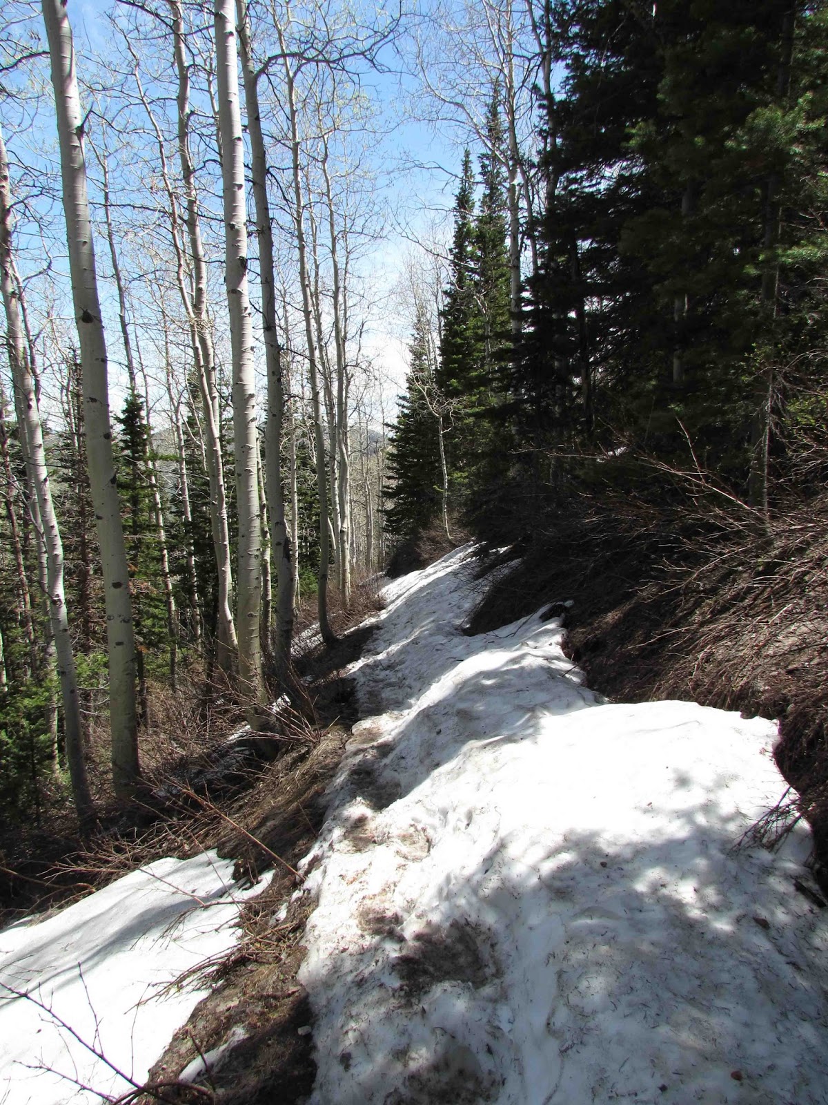
Overcast morning but in mid-60's. Heading to Farmington Canyon to walk the Farmington Creek Trail. This is a 3.2 mi round-trip w/ 1178' elevation. Its rated as one of the best 60 hikes within 60 miles of SLC (accordingly to the author of a book I have). Its said to be the best in early spring and then in fall. After walking the trail, I understand why - trees w/ leaves! The trail follows Farmington Trail -- actually about 100-200ft above it. The trail is surrounded by tree - scrub oak, maples and at the higher parts pines. So although I can hear the creek (and it roaring with the spring runoff), I can't see it for most of the trail. There are openings and very exposed sections that give peeks of the river but mostly they are good looks of the canyon and a good view of Farmington, Farmington Bay and Antelope Island.
As with all trails so far, its starts uphill. The creek is to the right. Hard to see because the scrub oak and maples have leafed out. To the left, its uphill and trees (or in some spots, rocky slopes). There are bunches of allium blooming -- either wild garlic or onion, I suspect garlic -- w/ little light pinkish/purple flowers.
Its everywhere on the first part of the trail. There are also yellow daisy-like flowers here and there.
At times, I can see the creek below but its through branches and leaves, though not really good looks. Little lizards are moving through the woods. Finally, an opening with a good view of the canyon and look back at Farmington.
Finally, I get a good look at a dragonfly in UT. It is a large blue dragonfly. I think it just emerged as it's body is bent and its also not flying long distances. Guess I'll see what it looks like when I come back through.
I have my first creek crossing, this is not Farmington Creek but a smaller creek that feeds into Farmington. It has a small waterfall to the left and a drop-off to the right. I have to rock hop to cross.
Some of the sections are quite exposed with a rocky cliff on the left and a nice drop to the right.
And then back into the forest again. The forest opens at times to see the creek w/ its rapids and small waterfalls. There were a bunch of flower trees blooming -- one looked like a cherry tree (choke cherry maybe) But they all smelled great!!
Snake! It quickly crosses in front of me. He was moving fast and so was my heart! It was smaller than the snake I saw going up Grandeur Peak, but looked like the same kind (which I haven't figure out yet). At least its not a Rattlesnake (whew)!
There's a second creek crossing, this one is bigger than the first. Then its the home stretch to a pretty good view of a pretty large waterfall. There is a way to get down to it but its pretty steep. I'll just stay high. After the waterfall, there was a small side trail than led down to the creek (pretty level trail). This would be an excellent camping spot! It had the creek right next to it.
It was about at this point, I was thinking that this was a pretty easy 1000ft elevation change. Then there was a fork in the trail. To the right, the trail stayed close to the river but got a little sketchy. The left, well, here was a fair bit of the remaining elevation change. I knew it was heading to the campground (which is the ending point). I thought about not going but I was optimistic that at the top was a nice little meadow with flowers, so to satisfy my curiosity I up went.
When I got to the top, I was greeted by a dirt road and camper! Oh well!
At least I got to see a Solomon's Seal in bloom. I've spotted these plants on multiple hikes, but this is the first time for a bloom. (This is plant is also found in Midwest woodlands.)
The trip back was sunnier (it was afternoon). There were more bflies zipping around.(Especially around the creeks.) I think for the day I saw, Cabbage White, Western Tailed Blue, Azure, Anise Swallowtail (kinda white one), Rocky Mt Duskywing, Juba Skippers, a Northern Cloudywing (which is new for the year - yea!) and the prize of the hike, a Dotted Blue! On the way out, I saw that the buckwheat plants were blooming near the beginning of the trail. Many Blue species love buckwheat. On the way back, there were some skippers and whites flying so I stopped to check the buckwheat. And sure enough on one of the flowers near trail was a blue. Of course, he flew and landed on another plant higher. Walking up was not option (too steep), so I tossed small rocks up the hill to try to get it to move to a better location. Of course, he goes higher :) Tried several time w/o success. But I did manage to get a few pictures thanks to super zoom.
I checked the other buckwheat plants on the way down but nothing.
More dragonflies out. Same as the one I saw on the way up the trail. No bent ones and they are not landing; just cruising along.
And those rustling in the woods that I thought were just lizards moving around, .... well not all lizards, I saw a baby snake too!
Also saw a hummingbird moth
and as strange as it may seem, a old black pickup truck on the downside of the trail. Seems that this truck, back in the 50-60s, failed to stay on the switchbacks of the dirt road going up the canyon. Oops - can't think it was a happy ending.
But this trip for me was a happy ending!
Monday, May 27, 2013
Saturday, May 25, 2013
May 25 - Lamb Canyon
Heading to Lamb's Canyon today for a 1.75 (1540ft elevation change to just over 8000ft) mile hike to the Millcreek overlook (and the reverse hike back out). Lamb's Canyon is an exit or two away from Park City off HWY 80. And it is listed as a good bfly spot :) The trailhead is about 1.5miles from the exit. The road goes uphill and follows a stream. The west-facing hillside has numerous blooming flowers - yellow, purple, forget-me-knots, bluebells - fabulous. (And there are butterflies about even though the sun isn't high enough in the sky to soak the area in sunlight -- that's a good sign.)
The parking for the trailhead is small - only 5-6 cars, so I park on the road. The trail starts by crossing a bridge over the creek (there's supposed to be native cutthroat trout in that creek - but I don't see any). The trail starts with a series of switchbacks through a woods of Douglas Fir, aspens and other pines. Pretty shading. But there is one purple flower blooming - its a vine. I looks like a clematis (its really a Western Virgin's Bower).
The sounds of the creek (not the main one as that continues up the road) and small streams continue much of the way up the trail. There are openings of sunlight and with those openings, there are butterflies, mostly blues (combination of Silvery, Spring Azures, and Western Tailed Blues) and the Sara Orangetips and flowers.
The trail is a bit rustic (I like that) as there was at least 4 spots that I had to climb over a fallen tree.
Moose definitely like this trail as I see large hook prints and moose scat in many locations. The further up I go I start to see waterleaf, bluebells, and other plants that I've been seeing this Spring.
Lots of Mourning Cloaks on this trail!
I get a surprise on the trail by a small brown-reddish bfly. Its an elfin -- the only elfin I know that flies in UT in the Desert Elfin -- this cannot be a Desert Elfin, totally wrong habitat. Looks like a Brown Elfin. (I checked when I got home, the Brown Elfin does fly in a very small portion of northern UT -- I was in that portion today. Definitely redder than the ones in WI -- perhaps its just fresher.)
About a mile in, there are patches of snow. And with the snow, strangely, the Commas appear. (Never got a good ID on them but pretty sure based on past experiences, they are a combination of Satyr and Hoary Commas.) Pretty strange (and cool) to see these butterflies flying over the snow.
Not a lot of good views from the trail as it is in the canyon and thick woods. But I like it!
The further up, the more snow -- the snow is in the areas that don't get a lot of lights -- everything else is snowfree. Finally, the trail, in parts, is covered in snow. So slippery, careful crossing is required in spots. This is all the way to the top.
At the top, to the left is a field on snow,
to the right and to the front is snow-free, aspens, and lots of plants that are not quite blooming yet. There are mountains a lot of snow on them visible.
This is the Millcreek viewpoint (my destination for today) and there is a nice view of SLC in the distance.
I stop for lunch and can smell the bergamot plants (minty) and see columbine and lots of others. Boy, will this look great in a few weeks! I also see the Orangetips and I finally get a photo - thanks to a gusty wind that knocked the bfly to the ground (I'll take it).
The return trip was a bit lighter as the sun was up high so the forest wasn't as dark. Which means more bfly activity. The commas were still flying -- and over the snow. The Mourning Cloaks were even more abundant. I got to watch 2 in aerial combat; swirling around each other going up, up, up higher than one of the Douglas Fir trees. Can't beat for entertainment!
After the hike, I went looking for bflys. Behind the parking area was a great spot -- Mylitta Crescents, Spring Whites, Sara Orangetips, Juba Skippers all dancing around.
Then there was an area along side the road that was wet or filled with water. Perfect bfly spot. Saw Rky Mt Duskwing, Blues, Sleepy Duskwing and I finally got my photo of the Anise Swallowtail (Yea!).
I walked further down the road for about 1/2 miles checking for bflys. Then came back and drove up the road until it dead-ends. The area up the road opened up, the stream was in full view and not in trees. There were hillsides of flowers (like the lower section) -- can't wait to see these when the summer bflys start flying.
I really liked this trail -- I'm not sure why. Perhaps it was its solitude (not a lot of people, no bikers); perhaps it was flowers/bflys, the snow; perhaps it was the potential for a great flower season... I just liked it and will be back.
The parking for the trailhead is small - only 5-6 cars, so I park on the road. The trail starts by crossing a bridge over the creek (there's supposed to be native cutthroat trout in that creek - but I don't see any). The trail starts with a series of switchbacks through a woods of Douglas Fir, aspens and other pines. Pretty shading. But there is one purple flower blooming - its a vine. I looks like a clematis (its really a Western Virgin's Bower).
The sounds of the creek (not the main one as that continues up the road) and small streams continue much of the way up the trail. There are openings of sunlight and with those openings, there are butterflies, mostly blues (combination of Silvery, Spring Azures, and Western Tailed Blues) and the Sara Orangetips and flowers.
The trail is a bit rustic (I like that) as there was at least 4 spots that I had to climb over a fallen tree.
Moose definitely like this trail as I see large hook prints and moose scat in many locations. The further up I go I start to see waterleaf, bluebells, and other plants that I've been seeing this Spring.
Lots of Mourning Cloaks on this trail!
I get a surprise on the trail by a small brown-reddish bfly. Its an elfin -- the only elfin I know that flies in UT in the Desert Elfin -- this cannot be a Desert Elfin, totally wrong habitat. Looks like a Brown Elfin. (I checked when I got home, the Brown Elfin does fly in a very small portion of northern UT -- I was in that portion today. Definitely redder than the ones in WI -- perhaps its just fresher.)
About a mile in, there are patches of snow. And with the snow, strangely, the Commas appear. (Never got a good ID on them but pretty sure based on past experiences, they are a combination of Satyr and Hoary Commas.) Pretty strange (and cool) to see these butterflies flying over the snow.
Not a lot of good views from the trail as it is in the canyon and thick woods. But I like it!
The further up, the more snow -- the snow is in the areas that don't get a lot of lights -- everything else is snowfree. Finally, the trail, in parts, is covered in snow. So slippery, careful crossing is required in spots. This is all the way to the top.
At the top, to the left is a field on snow,
to the right and to the front is snow-free, aspens, and lots of plants that are not quite blooming yet. There are mountains a lot of snow on them visible.
This is the Millcreek viewpoint (my destination for today) and there is a nice view of SLC in the distance.
I stop for lunch and can smell the bergamot plants (minty) and see columbine and lots of others. Boy, will this look great in a few weeks! I also see the Orangetips and I finally get a photo - thanks to a gusty wind that knocked the bfly to the ground (I'll take it).
The return trip was a bit lighter as the sun was up high so the forest wasn't as dark. Which means more bfly activity. The commas were still flying -- and over the snow. The Mourning Cloaks were even more abundant. I got to watch 2 in aerial combat; swirling around each other going up, up, up higher than one of the Douglas Fir trees. Can't beat for entertainment!
After the hike, I went looking for bflys. Behind the parking area was a great spot -- Mylitta Crescents, Spring Whites, Sara Orangetips, Juba Skippers all dancing around.
Then there was an area along side the road that was wet or filled with water. Perfect bfly spot. Saw Rky Mt Duskwing, Blues, Sleepy Duskwing and I finally got my photo of the Anise Swallowtail (Yea!).
I walked further down the road for about 1/2 miles checking for bflys. Then came back and drove up the road until it dead-ends. The area up the road opened up, the stream was in full view and not in trees. There were hillsides of flowers (like the lower section) -- can't wait to see these when the summer bflys start flying.
I really liked this trail -- I'm not sure why. Perhaps it was its solitude (not a lot of people, no bikers); perhaps it was flowers/bflys, the snow; perhaps it was the potential for a great flower season... I just liked it and will be back.
May 24 - Jordan River Trail
Had a couple of trails lined up for today but was moving like a turtle this morning. So since I had to due errands either today or Sat, today was errand day.
But still had time in the afternoon to go on a 5+ mile way down the Jordan River Parkway. Part of its in back of my house -- unfortunately I have to drive to it because its on the West side of the Jordan River, I live on the east side and there is no bridge nearby.
The Parkway is basically an urban trail that runs about 46 miles along the river -- and the Jordan River is one of a few rivers in North America that actually runs north.
The section I walk (and I've been on it many times already) is from 7200 to about 9000 in West Jordan. The first part of the trail is sandwiched between the river on the west and the Trax (commuter train) on the east. Once the trail crosses under 7800, the river is on the west and what was probably an old garbage dump on the east. The 7200-7800 is mostly a disturbed area with non-native weedy plants -- today lots of mustard species, yarrow, etc blooming. After 7800, is more native desert species especially along the river. Its very pretty (and getting prettier as the plants start blooming).
Hoping to see some butterflies but its around 3:30 so we'll see. Not long after starting the trail, butterflies -- they're whites -- probably Cabbage White (common all over US) but here in the West, they can also be Western Whites, Checkered Whites or Mustard Whites. They really need to stop so I can get a better look. They're plentiful...but flying. Finally, one lands and its not a Cabbage. Its a Checkered White!
I've seen them before but this is the first in UT! There are also Cabbage flying.
Came upon one section with lots of blooming white flowers (some mustard plant). Plenty of whites, but there are 2 smaller orange's bflys. I only get a quick look before they fly in aerial combat. I try to follow but that quickly ends as they fly through a fence. They were definitely 2 different species. The one looked like a Copper, the other either a Crescent or Checkerspot. Hopefully, they'll still be here when I come back down the trail.
I get a quick look at a male quail. They're funny looking with the curly feathers hanging in front of their heads.
After 7800, not many bflys -- just a few whites. But there are damselflies! Brown and Blue ones! And then I see a dragonfly - looks like female Green Darner (they're blue)! I was expecting to see more bflys on this section but it didn't happen. Perhaps a little later in the season. I do see a King Fisher.
On the way back, on the top of a tree is a very tiny bird. I zoom in with my camera and its a hummingbird!
I see another quail pair. They're walking down the trail in front of me. Problem, there are 3 bikes pedaling towards the quail. They're sandwiched between me and the oncoming bikes. I can see they are trying to decide what to do -- the only exit is to the left toward the river. The female is in front of the male. All of a sudden, the male quickens its pace, rushes past the female and ducks into the vegetation at the river. So much for the male protector; leaving his lady out to fend for herself. :) The female quickly follows.
On one of my earlier walks, I noticed nests hanging from some of the trees. They looked like oriole nests. Well, I confirmed today they are oriole nests!!!
I get back to the spot where I originally saw the small orange butterflies. Luckily, the one I think is a Copper is still there!! Yea! (Its a Purplish Copper) I looked for the other species, but nothing.
I continue down the trail a bit further and I see the other bfly chasing a Sulpher (yellow bfly). What a bully! I go off trail into the flowers/plants but I lose it. But I see more Purplish Coppers. I continue and see a Red Admiral and finally catch sight of the bfly. Finally, I get a good look. It's a Mylitta Crescent.
Excellent day!
But still had time in the afternoon to go on a 5+ mile way down the Jordan River Parkway. Part of its in back of my house -- unfortunately I have to drive to it because its on the West side of the Jordan River, I live on the east side and there is no bridge nearby.
The Parkway is basically an urban trail that runs about 46 miles along the river -- and the Jordan River is one of a few rivers in North America that actually runs north.
The section I walk (and I've been on it many times already) is from 7200 to about 9000 in West Jordan. The first part of the trail is sandwiched between the river on the west and the Trax (commuter train) on the east. Once the trail crosses under 7800, the river is on the west and what was probably an old garbage dump on the east. The 7200-7800 is mostly a disturbed area with non-native weedy plants -- today lots of mustard species, yarrow, etc blooming. After 7800, is more native desert species especially along the river. Its very pretty (and getting prettier as the plants start blooming).
Hoping to see some butterflies but its around 3:30 so we'll see. Not long after starting the trail, butterflies -- they're whites -- probably Cabbage White (common all over US) but here in the West, they can also be Western Whites, Checkered Whites or Mustard Whites. They really need to stop so I can get a better look. They're plentiful...but flying. Finally, one lands and its not a Cabbage. Its a Checkered White!
I've seen them before but this is the first in UT! There are also Cabbage flying.
Came upon one section with lots of blooming white flowers (some mustard plant). Plenty of whites, but there are 2 smaller orange's bflys. I only get a quick look before they fly in aerial combat. I try to follow but that quickly ends as they fly through a fence. They were definitely 2 different species. The one looked like a Copper, the other either a Crescent or Checkerspot. Hopefully, they'll still be here when I come back down the trail.
I get a quick look at a male quail. They're funny looking with the curly feathers hanging in front of their heads.
After 7800, not many bflys -- just a few whites. But there are damselflies! Brown and Blue ones! And then I see a dragonfly - looks like female Green Darner (they're blue)! I was expecting to see more bflys on this section but it didn't happen. Perhaps a little later in the season. I do see a King Fisher.
On the way back, on the top of a tree is a very tiny bird. I zoom in with my camera and its a hummingbird!
I see another quail pair. They're walking down the trail in front of me. Problem, there are 3 bikes pedaling towards the quail. They're sandwiched between me and the oncoming bikes. I can see they are trying to decide what to do -- the only exit is to the left toward the river. The female is in front of the male. All of a sudden, the male quickens its pace, rushes past the female and ducks into the vegetation at the river. So much for the male protector; leaving his lady out to fend for herself. :) The female quickly follows.
On one of my earlier walks, I noticed nests hanging from some of the trees. They looked like oriole nests. Well, I confirmed today they are oriole nests!!!
I get back to the spot where I originally saw the small orange butterflies. Luckily, the one I think is a Copper is still there!! Yea! (Its a Purplish Copper) I looked for the other species, but nothing.
I continue down the trail a bit further and I see the other bfly chasing a Sulpher (yellow bfly). What a bully! I go off trail into the flowers/plants but I lose it. But I see more Purplish Coppers. I continue and see a Red Admiral and finally catch sight of the bfly. Finally, I get a good look. It's a Mylitta Crescent.
Excellent day!
Wednesday, May 22, 2013
May 19 - Bryce Canyon
Last day of trip. Sunny and clear. (Big storms over SLC -- and storms in the forecast).
Park the car at Inspiration Point and checkout the overlook. Bryce Canyon is sooo beautiful!
We decide to walk down along the rim to Sunset and then Sunrise Points. The plan is to walk the Queen's Garden and Navaho Loops -- down into and then back out of the canyon. There were lots of people on the Navaho Loop (looked like a human antfarm) but the Queen's Garden trail was pretty.
This is a great trail as it slowly angles down into the canyon past the rocky spires.
Towards the bottom, there's the Queen's Garden. I somehow missed it last time I was here so I made I saw -- nothing to exciting.
The bottom part of the canyon trail was empty (no people). Last time I was down (its was in Sept), all the trees had rocks on all their branches (placed by people of course). But it was just bare branches now -- maybe later in the season....
When we got close to the Navaho Loop, there was definitely more people. I wanted to go up the Wall Street side (between 2 narrow rocks/building) but it was closed due to unsafe condition (rock slides). So we went up the other side (by Thor's Hammer). The trail goes up past 2 rock bridges
and up a series of switchbacks to the top and Thor's Hammer.
By the time we got up to the top, the nice clear skies were cloudy and looking like rain. :(
Took the tram to the visitor's center for a quick look and then rode back into the park to get my car. The tram driver said that SLC above 8000ft was getting snow. And it is now very dark here.
Got my car and starting driving to the end of the road in Bryce Canyon - Rainbow Point (its over 9000ft). Spotted a Pronghorn. And then it started to drizzle, and the temperature starting to drop and it started to snow!!!! It got as low at 39 degrees so it wasn't sticking but it was still snowing. (This day is a groundhog day for me because it is an exact repeat of when I was here in Sept a couple of years ago - sunny, then cloudy, then snow/hail -- I'm never coming here again)
Because of the clouds, Rainbow Point wasn't too scenic. Pretty much the same as we stopped at some of the viewpoints on the way back down. But we had great day!
Just a long drive home --- but a lovely week-end with my nephew!!
Park the car at Inspiration Point and checkout the overlook. Bryce Canyon is sooo beautiful!
We decide to walk down along the rim to Sunset and then Sunrise Points. The plan is to walk the Queen's Garden and Navaho Loops -- down into and then back out of the canyon. There were lots of people on the Navaho Loop (looked like a human antfarm) but the Queen's Garden trail was pretty.
This is a great trail as it slowly angles down into the canyon past the rocky spires.
Towards the bottom, there's the Queen's Garden. I somehow missed it last time I was here so I made I saw -- nothing to exciting.
The bottom part of the canyon trail was empty (no people). Last time I was down (its was in Sept), all the trees had rocks on all their branches (placed by people of course). But it was just bare branches now -- maybe later in the season....
When we got close to the Navaho Loop, there was definitely more people. I wanted to go up the Wall Street side (between 2 narrow rocks/building) but it was closed due to unsafe condition (rock slides). So we went up the other side (by Thor's Hammer). The trail goes up past 2 rock bridges
and up a series of switchbacks to the top and Thor's Hammer.
By the time we got up to the top, the nice clear skies were cloudy and looking like rain. :(
Took the tram to the visitor's center for a quick look and then rode back into the park to get my car. The tram driver said that SLC above 8000ft was getting snow. And it is now very dark here.
Got my car and starting driving to the end of the road in Bryce Canyon - Rainbow Point (its over 9000ft). Spotted a Pronghorn. And then it started to drizzle, and the temperature starting to drop and it started to snow!!!! It got as low at 39 degrees so it wasn't sticking but it was still snowing. (This day is a groundhog day for me because it is an exact repeat of when I was here in Sept a couple of years ago - sunny, then cloudy, then snow/hail -- I'm never coming here again)
Because of the clouds, Rainbow Point wasn't too scenic. Pretty much the same as we stopped at some of the viewpoints on the way back down. But we had great day!
Just a long drive home --- but a lovely week-end with my nephew!!
May 18 - Capitol Reef National Park
Got an early start this morning. Cool, sunny with some fluffy clouds, perfect day for hiking. Stopped at the Visitors Center for some hiking advice (I've been here and hiked here before but on the longer trails, was looking for some a bit less intense today.)
The trails to Navaho Knobs and Hickman Bridge (both great places/hikes) were closed due to a rock slide very near the trailhead.
We decided on Cassidy Arch -- a pothole arch. The trail starts after a short drive up the Grand Wash. There were some deer (yes, scruffy ones) standing near the turnoff into the Wash. And there was an old Uranium Mine which we had to stop and take a look at. (Lots of old uranium mines in this part of UT).

Stopped at an Arch viewpoint from the road (600ft below the arch).
Then off to the trailhead parking. Not many people here yet. The short walk up the wash had some great formations in the rock -- ones to peer thru, peer over, lay-in and even sit in.
The trail is 1.5 miles and 600ft+ of elevation. It starts with a series of steps (of various sizes, shapes) along the side of the rock formation. (Its a straight drop if you mess up). The views are tremendous with every step up I take.
It finally levels off and the trail gets wider. For most of this, the arch is not visible. But eventually, it appears....and disappears again.
Finally, we get to the slickrock portions and luckily slickrock is actually pretty sticky because there were some steep ups. But the daredevil that I am tried to get up a section that was just a bit too steep and ended up sliding back down on my backside.
But we made it to the arch. Pretty cool as you look down on at it because it formed as a hole in the rock.
I could've stood on the top of the arch but I did that once before and its a little intimidating for me (once is enough). We took a rest enjoying the day before we headed down to a overflowing parking area. (I'm so glad we left early, we only had to share the arch with a handful of folks.)
The next stop was lunch at the entrance to Capitol Gorge. Didn't walk the gorge as originally planned, getting late and about time to head to Bryce Canyon. Took a quick stop at the Goosenecks (another gorge overlook) and walked the Sunset Point trail -- great overlooks during the day, definitely would be a great hike at Sunset. Oh yea, we saw this squirrel/rodent; it has a long skinny tail and it had some hops. It was leaping up rocks like a kangaroo. Pretty amazing to watch.
On the way to Goosenecks, had to stop for a stunningly red blooming cactus called Claret Cup!
We took Hwy 12 down to Bryce Canyon. This is a Scenic Byway and it certainly lives up to that. Great views of the Grand Staircase areas, mountains (summit at 9600ft - yes, snow) and a drive over the Hogsback (one of a few times I actually have had a death grip on my steering wheel). This road is 2 lanes with no room to pull-off as it is over a very narrow section of rock (the hog's back). There are a few pull-offs for viewing. On both sides are drop-offs of 2000ft. The views are stunning. (thanks to the CCC folks who completed the road in 1935!)
Took a quick trip to Fairyland Point just outside the Bryce Canyon gate in the evening. It was a little too dark for a good view BUT we did see a pronghorn antelope on the way out.
The trails to Navaho Knobs and Hickman Bridge (both great places/hikes) were closed due to a rock slide very near the trailhead.
We decided on Cassidy Arch -- a pothole arch. The trail starts after a short drive up the Grand Wash. There were some deer (yes, scruffy ones) standing near the turnoff into the Wash. And there was an old Uranium Mine which we had to stop and take a look at. (Lots of old uranium mines in this part of UT).
Stopped at an Arch viewpoint from the road (600ft below the arch).
Then off to the trailhead parking. Not many people here yet. The short walk up the wash had some great formations in the rock -- ones to peer thru, peer over, lay-in and even sit in.
The trail is 1.5 miles and 600ft+ of elevation. It starts with a series of steps (of various sizes, shapes) along the side of the rock formation. (Its a straight drop if you mess up). The views are tremendous with every step up I take.
It finally levels off and the trail gets wider. For most of this, the arch is not visible. But eventually, it appears....and disappears again.
Finally, we get to the slickrock portions and luckily slickrock is actually pretty sticky because there were some steep ups. But the daredevil that I am tried to get up a section that was just a bit too steep and ended up sliding back down on my backside.
But we made it to the arch. Pretty cool as you look down on at it because it formed as a hole in the rock.
I could've stood on the top of the arch but I did that once before and its a little intimidating for me (once is enough). We took a rest enjoying the day before we headed down to a overflowing parking area. (I'm so glad we left early, we only had to share the arch with a handful of folks.)
The next stop was lunch at the entrance to Capitol Gorge. Didn't walk the gorge as originally planned, getting late and about time to head to Bryce Canyon. Took a quick stop at the Goosenecks (another gorge overlook) and walked the Sunset Point trail -- great overlooks during the day, definitely would be a great hike at Sunset. Oh yea, we saw this squirrel/rodent; it has a long skinny tail and it had some hops. It was leaping up rocks like a kangaroo. Pretty amazing to watch.
On the way to Goosenecks, had to stop for a stunningly red blooming cactus called Claret Cup!
We took Hwy 12 down to Bryce Canyon. This is a Scenic Byway and it certainly lives up to that. Great views of the Grand Staircase areas, mountains (summit at 9600ft - yes, snow) and a drive over the Hogsback (one of a few times I actually have had a death grip on my steering wheel). This road is 2 lanes with no room to pull-off as it is over a very narrow section of rock (the hog's back). There are a few pull-offs for viewing. On both sides are drop-offs of 2000ft. The views are stunning. (thanks to the CCC folks who completed the road in 1935!)
Took a quick trip to Fairyland Point just outside the Bryce Canyon gate in the evening. It was a little too dark for a good view BUT we did see a pronghorn antelope on the way out.
May 17: Buckhorn/Cottonwood Wash
I have company this trip - my oldest nephew Mike. And we're heading south ultimately towards Capitol Reef and Bryce Canyon.
Nice warmish day but rain is predicted and we're heading to explore The Wedge and Buckhorn Wash Road. We're approaching from the North by turning east on HWY 6 through the mountains toward Price. Last time I was thru this area, there was still snow on the ground but not today - pretty green. When we got to Price, turn south towards Castledale. Just before Castledale, left turn onto Green River Cutoff Rd. This is the start of the journey on BLM roads (dirt/rocks) thru the San Rafael Swell. And I will add, nicely kept and marked BLM roads. :)
There a bunch of roads thru this area, some going to Dinosaur Quarries and various scenic locations. The BLM is building a visitor center on the Green River Cutoff Rd to help draw more people to this wonderful area. There's plenty of information on the area on the area, with maps, points of interest etc. And I had my printout for the Wash.
First stop was The Wedge - or UT's Little Grand Canyon and yes, it was very nice and deserving of its name.
We also got lucky and hit the desert flower spring bloom - white, red, orange, purple, yellow -- the most I've seen yet! And going to keep me busy identifying them.
We saw our first lizard here (one of many). This little guy looked like he was wearing a toupee. :)
After the Wedge, onto Buckhorn Wash. This is a 22.7 mile drive thru the wash, tall canyon walls, etc. Still lots of flowers and in some of the wetter spots near the San Rafael River, trees -- probably good bflying spots if it were sunny.
The first stop was the Morrison Knudsen Tunnel. This tunnel was dug by the DoD in 1948 for some Top Secret experiment. The guide marker said its unclassified but unfortunately did not give the reason for the hole. We did peer in and when we turned around we almost got face full of raven feathers...as a raven appeared to be landing just where we were trying to exit. Not sure who was more shocked.
Then off to a dinosaur track - which was not marked from the road (the internet guide indicated folks have vandalized it in the past).
Next was the first of a few petroglyph. This one was some but it was easily found because and I quote from the internet guide "so look for a series of bullet holes where some fool shot his initials". The initials were clear as day from the road -- not so much for a petroglyph.
A short distance down the road was another large panel of petroglyphs which aren't visible from the road but well worth the short hike.
And then finally the 130ft petroglyph wall. The panel is said to be over 2000yrs old. It has pix (in red pigment) from the "Barrier Canyon Culture" and others from the Fremont Indians.
Can't forget the swinging bridge crossing the San Rafael River which was built by the CCC in 1938. The bridge is no longer used.
It was a fun ride and I'm so glad a couple of people at work suggested the road. But its off to Capitol Reef.
The day was supposed to be 77degrees - short/t-shirt weather but in the wash it only made it that high for a couple miles -- mostly windy and upper 60s. We took the scenic (thru the mts) way to Torrey UT and the rain clouds were building so there wasn't much sun. When we got to the summit at just under 9000ft is was 48 degrees and extremely blustery. Not a good day for shorts and no jackets :)
But there still was some snow at the summit -- too cold to get out of the car to play.
Lots of cattle grazing along the road (had to stop for a few). Its very lush and green - much different from the Wash we just exited. Saw about 10 deer on the side of the road.
Thankfully the temperature rose a bit as we went down and it was back in the low 60s when we got to Torrey.
Very cloudy now but the sun was peaking thru in spots. We took an evening drive into the beginnings of Capitol Reef and those peaks of sun made for some beautiful highlights on the Capitol Reef rock formations.
The controversy of the day were 5 deer that were in the front yard of a house in Torrey. When I saw them, I thought "Boy are they scruffy deer". My nephew thought they were fake. I was almost buying it (as I've never seen deer like that) but we saw some other deer that evening and they were real AND they were scruffy. Unfortunately, we left town with me forgetting to drive back past the house so its still unknown whether they were real deer or fake but the controversy still exists.....
Nice warmish day but rain is predicted and we're heading to explore The Wedge and Buckhorn Wash Road. We're approaching from the North by turning east on HWY 6 through the mountains toward Price. Last time I was thru this area, there was still snow on the ground but not today - pretty green. When we got to Price, turn south towards Castledale. Just before Castledale, left turn onto Green River Cutoff Rd. This is the start of the journey on BLM roads (dirt/rocks) thru the San Rafael Swell. And I will add, nicely kept and marked BLM roads. :)
There a bunch of roads thru this area, some going to Dinosaur Quarries and various scenic locations. The BLM is building a visitor center on the Green River Cutoff Rd to help draw more people to this wonderful area. There's plenty of information on the area on the area, with maps, points of interest etc. And I had my printout for the Wash.
First stop was The Wedge - or UT's Little Grand Canyon and yes, it was very nice and deserving of its name.
We also got lucky and hit the desert flower spring bloom - white, red, orange, purple, yellow -- the most I've seen yet! And going to keep me busy identifying them.
We saw our first lizard here (one of many). This little guy looked like he was wearing a toupee. :)
After the Wedge, onto Buckhorn Wash. This is a 22.7 mile drive thru the wash, tall canyon walls, etc. Still lots of flowers and in some of the wetter spots near the San Rafael River, trees -- probably good bflying spots if it were sunny.
The first stop was the Morrison Knudsen Tunnel. This tunnel was dug by the DoD in 1948 for some Top Secret experiment. The guide marker said its unclassified but unfortunately did not give the reason for the hole. We did peer in and when we turned around we almost got face full of raven feathers...as a raven appeared to be landing just where we were trying to exit. Not sure who was more shocked.
Then off to a dinosaur track - which was not marked from the road (the internet guide indicated folks have vandalized it in the past).
Next was the first of a few petroglyph. This one was some but it was easily found because and I quote from the internet guide "so look for a series of bullet holes where some fool shot his initials". The initials were clear as day from the road -- not so much for a petroglyph.
A short distance down the road was another large panel of petroglyphs which aren't visible from the road but well worth the short hike.
And then finally the 130ft petroglyph wall. The panel is said to be over 2000yrs old. It has pix (in red pigment) from the "Barrier Canyon Culture" and others from the Fremont Indians.
Can't forget the swinging bridge crossing the San Rafael River which was built by the CCC in 1938. The bridge is no longer used.
It was a fun ride and I'm so glad a couple of people at work suggested the road. But its off to Capitol Reef.
The day was supposed to be 77degrees - short/t-shirt weather but in the wash it only made it that high for a couple miles -- mostly windy and upper 60s. We took the scenic (thru the mts) way to Torrey UT and the rain clouds were building so there wasn't much sun. When we got to the summit at just under 9000ft is was 48 degrees and extremely blustery. Not a good day for shorts and no jackets :)
But there still was some snow at the summit -- too cold to get out of the car to play.
Lots of cattle grazing along the road (had to stop for a few). Its very lush and green - much different from the Wash we just exited. Saw about 10 deer on the side of the road.
Thankfully the temperature rose a bit as we went down and it was back in the low 60s when we got to Torrey.
Very cloudy now but the sun was peaking thru in spots. We took an evening drive into the beginnings of Capitol Reef and those peaks of sun made for some beautiful highlights on the Capitol Reef rock formations.
The controversy of the day were 5 deer that were in the front yard of a house in Torrey. When I saw them, I thought "Boy are they scruffy deer". My nephew thought they were fake. I was almost buying it (as I've never seen deer like that) but we saw some other deer that evening and they were real AND they were scruffy. Unfortunately, we left town with me forgetting to drive back past the house so its still unknown whether they were real deer or fake but the controversy still exists.....
Sunday, May 12, 2013
May 12 - Mueller Park Trail to Big (aka Elephant) Rock
Looking for an easy, leg stretching hike today and the winner is the Mueller Park Trail to Big Rock (or as the locals call it - Elephant Rock). It's outside the city of Bountiful which is a few miles north of SLC. The hike is 3.58mi and 1020ft (child's play) one way = 7.16mi total.
Parked outside of the park along side the road and by a creek w/ flowing water. Some really nice houses in this area. The first part of the trail is pretty shady as it climbs up thru the pine trees. This is the toughest part of the trail as it climbs out of the valley. Not a lot of plants due to the shade but there are quite a few of a plant that has already gone to seed (I think it a Glacier Lily). I can hear the creek below pretty much the way.
At just less than a mile, the trail opens up to a wonderful view of the valley, mountains, etc to the front
and turning back, a great view of Bountiful, the lake, Antelope Island.... According to my trail cheatsheet, I'm supposed to see Elephant Rock and I'm sure I do but I just can't decide which hilltop is the destination. But there's flowers now, similar stuff I've been seeing (waterleaf, balsamroot, etc). And there's butterflies! In this one stretch I feel like I'm on a Sara Orangetip highway but going in the wrong direction as they were all going downhill. (I wondered if they all go back uphill later in the day.) Unfortunately, they weren't taking rest stops on any of the flowers.
Also, there were lots of Juba Skippers. I was kicking them up all along the sunny spots on the entire trail or they were just zipping along from flower to flower. And their aerial combat maneuvers w/ other Jubas was quite entertaining.
The trail followed the contour of the hillside weaving in and out. The "in" portions were typically shady; and the "out", very sunny. Some impressive views on those sunny stretches. At around 2.5mi, I can hear a creek again down below and soon come to several footbridges - one crossing the creek and the others - just spots that need a bridge. Not too much further to go.
I finally get to the portion of the trail that goes left or right. The trail sheet says left. I'm expecting to walk for more than 100ft but boom -- 2 benches and a view down the valley - Bountiful, Lake, Antelope Island, Stansbury Island -- can't beat it! Would make a lovely sunset spot!
There are 2 bikers at the stop. I take my seat on the bench to enjoy the view. The one guy leaves and I meet Bob. He parked behind me (and we left at the same time) and he asks why a person from Illinois would pick this trail (I'm impressed that he even remembered me). I proceed to tell him that I moved here.......he told me that this was a great place for moose, and mountain lion have been seen here as well. Good times!!
After a quick lunch, time to head back. The Juba Skippers were still there doing their thing; no Orangetips. But the sunnier skies brought out the Rocky Mt Duskywing and I see my first Gray Hairstreak of the season!!!
And surprise, surprise, my second dragonfly in UT! He was blue and a long way up from water.
(Oh, and those plants with seedpods at the start of the trail, they were Glacier Lilies - the further up the trail I got, the more blooming Glacier Lilies I saw.)
Good day.
Parked outside of the park along side the road and by a creek w/ flowing water. Some really nice houses in this area. The first part of the trail is pretty shady as it climbs up thru the pine trees. This is the toughest part of the trail as it climbs out of the valley. Not a lot of plants due to the shade but there are quite a few of a plant that has already gone to seed (I think it a Glacier Lily). I can hear the creek below pretty much the way.
At just less than a mile, the trail opens up to a wonderful view of the valley, mountains, etc to the front
and turning back, a great view of Bountiful, the lake, Antelope Island.... According to my trail cheatsheet, I'm supposed to see Elephant Rock and I'm sure I do but I just can't decide which hilltop is the destination. But there's flowers now, similar stuff I've been seeing (waterleaf, balsamroot, etc). And there's butterflies! In this one stretch I feel like I'm on a Sara Orangetip highway but going in the wrong direction as they were all going downhill. (I wondered if they all go back uphill later in the day.) Unfortunately, they weren't taking rest stops on any of the flowers.
Also, there were lots of Juba Skippers. I was kicking them up all along the sunny spots on the entire trail or they were just zipping along from flower to flower. And their aerial combat maneuvers w/ other Jubas was quite entertaining.
The trail followed the contour of the hillside weaving in and out. The "in" portions were typically shady; and the "out", very sunny. Some impressive views on those sunny stretches. At around 2.5mi, I can hear a creek again down below and soon come to several footbridges - one crossing the creek and the others - just spots that need a bridge. Not too much further to go.
I finally get to the portion of the trail that goes left or right. The trail sheet says left. I'm expecting to walk for more than 100ft but boom -- 2 benches and a view down the valley - Bountiful, Lake, Antelope Island, Stansbury Island -- can't beat it! Would make a lovely sunset spot!
There are 2 bikers at the stop. I take my seat on the bench to enjoy the view. The one guy leaves and I meet Bob. He parked behind me (and we left at the same time) and he asks why a person from Illinois would pick this trail (I'm impressed that he even remembered me). I proceed to tell him that I moved here.......he told me that this was a great place for moose, and mountain lion have been seen here as well. Good times!!
After a quick lunch, time to head back. The Juba Skippers were still there doing their thing; no Orangetips. But the sunnier skies brought out the Rocky Mt Duskywing and I see my first Gray Hairstreak of the season!!!
And surprise, surprise, my second dragonfly in UT! He was blue and a long way up from water.
(Oh, and those plants with seedpods at the start of the trail, they were Glacier Lilies - the further up the trail I got, the more blooming Glacier Lilies I saw.)
Good day.
Subscribe to:
Posts (Atom)